N for Nomenclature of the municipality

Many places in Tasmania are named after English towns, rivers and mountains. But let’s look at Sorell municipality to find out how places were named. I have used a few sources:

  1. Pretyman Index – found in Libraries Tasmania – can search online by clicking my link
  2. Where in Tasmania? A compilation of place names and their histories in Tasmania – in two parts A-K and L-Z
  3. Tasplaces : over 16 000 Tasmanian placenames and where to find them – reference book found in many Tasmanian Libraries
  4. Tasmanian nomenclature: the place-names of the state : record of origins and dates / compiled by ‘Nomen’. – pamphlet found in the reading room in Hobart library
  5. A dictionary of Tasmanian place-names 1993 – found in the reading room in Hobart library
  6. Australian Dictionary of Biography – found online
  7. Newspaper link from Trove

Towns:

  • Sorell –  in honour of Lieutenant Governor Sorell by Lachlan Macquarie
  • Forcett – named after the home of James Gordon
  • Dunalley –  named by Captain Bayly (Army) after Lord Dunalley from whom he received his commission
  • Dodges Ferry – named after Ralph Dodge who ran a ferry in the area
  • Lewisham – named after Dr Arndell family – Norman papers
  • Nugent – originally part of Carlton Scrub, then divided into Ringarooma and Weedy Hills, then Nugent
  • Midway Point – formerly known as Middle Point
  • Orielton – Edward Lord married into the Owen family who owned property at Orielton, Wales
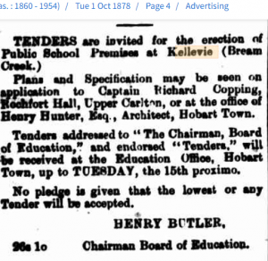
  • Copping – originally Coppington after Captain Richard Copping

Rivers/Creeks/Bays:

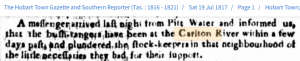
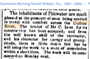
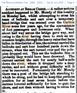
  • Carlton River – Baudin named the place River Brue in honour of one of his officers. Matthew Flinders later mistakenly marked it as Carlton River and this named was used for the district.
  • Iron Creek – known as Iron Rivulet in Meehan’s Field Books in 1803
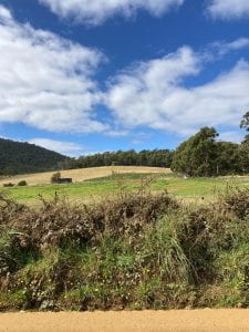
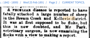
  • Bream Creek – black or silver bream caught there – mentioned in 1830 newspaper articles
  • Norfolk Bay – Baudin named it Port Buache, then Flinders named it Norfolk Bay after his schooner
  • Frederick Henry Bay – named Baie du Nord by D’Entrecasteaux (1792), Henshaw’s Bay by Hayes (1794) then its present name by Flinders (1798)
  • Marion Bay – named in 1802 by a member of Baudin ‘s expedition in honour of the French navigator Marion du Fresne

Many of the hills or mountains are named after early settlers of the district.

Hills: Dunbabins, Heans, Pearces, Dixons, Haytons, Steeles, Lesters, Bedelphs and Allanbys

  • Mt Elizabeth – after James Gordon’s wife
  • Gordon Sugarloaf – probably named after James Gordon
  • Ragged Tier –  between Copping and Bream Creek, named for the saw tooth look of the mountains
  • Wykeholm Hill – related to Anthony Wyke Steele owning property called Wykeholm
  • Ephraim Ridge – Ephraim Newitt – owner of property in the area
  • Wettenhall Flats – named after Lieutenant Robert Wettenhall

Readers: Do you know the origin of the following places in the municipality?

  • Mother Browns Bonnet
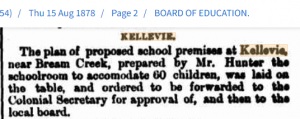
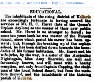
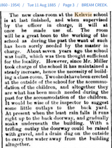
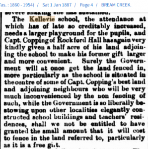
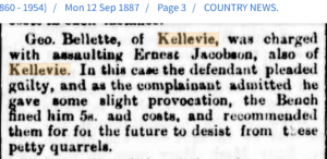
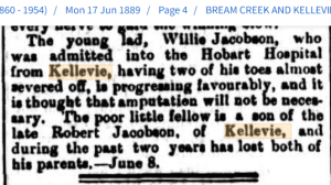
  • Kellevie
  • Pickety Hill
  • Spankers Hill

K for Kellevie

Land near Kellevie 2022

Kellevie is a rural area in the municipality about 28 kilometres east of Sorell. Looking at newspapers mentioning Kellevie, it has certainly changed over time. Before I began the research for this post, I thought Kellevie was a very small place in the back hills of Sorell. I now have a different view of the history of the area. Blue links take you to newspaper articles to read.

In 1853, there was 280 acres of land leased to John Picken in the parish of Kellevie.

In 1862, in the local newspaper Kellevie was mentioned as being in the County of Pembroke and that it was a parish in the area called Carlton Scrub along with Nugent and Canning parishes. It was listed as agricultural land.

In 1871, Kellevie is mentioned often under Crown Lands for rent. Here are some examples of how the land is described by Mr Crawford:

Stony forest land ; steep hills in part, coarse herbage throughout. Not capable of much improvement. Carrying capacity-300 sheep.
Rocky tier land, chiefly, eastern frontage. Rough she-oak hills with coarse edgy flats here and there. Soil poor. Not capable of much improvement. Carrying capacity-200 sheep.

By August 1878, plans were afoot for a school at Kellevie.

Tenders were out by October 1878 and specifications could be viewed at Rochfort Hall, Upper Carlton, the home of Richard Copping, a well known whaling captain.

Builders wanted!

November 1878 saw a very detailed description of Kellevie in the local paper. Mention of the many families in the area.

First school master appointed in 1879. But just over a year later the school is shut and the master removed. Why? A new appointment has been made.

School is ready for pupils
  • Even in 1881, teachers were moved around a lot, but in a five year period all head teachers had been promoted from the Sorell district.
  • By August 1882, just four years after being built, tenders were out for repairing the school premises at Kellevie. By November that year, it was ready to be started and they asked the Board of Education for a fortnight’s holiday while the repairs were done.
  • In August 1883, whooping cough was prevalent among the students and the school was closed for a week.
  • A letter to the editor mentioned the Kellevie school in November 1883, and the teachers held a tea in the evening for students and parents on the day school closed for Christmas holidays.
  • June 1884 where Matthew Burnett lectured on temperance to a very large crowd at Kellevie.
  • August 1884 the school was averaging 60 children each day with Mr and Mrs Miller still in charge.
  • The annual tea meeting in December 1884 includes names of many prize recipients. December 1885
New classroom
  • Discussion of postal service in Coppington and Forcett area including Kellevie.
  • Students mourn death of a school friend at Kellevie in February 1886.
  • The schoolmaster and mistress Mr and Mrs Miller moved to Bothwell. Farewell meeting at the schoolhouse in July 1886.
  • Mr Downie is the new schoolmaster in August 1886 and more trouble re the postal service.
  • Discussion about opening up roads to Kellevie to allow produce to get to Dunalley more easily.
  • Upper Carlton now officially known as Kellevie through the Post Office.
  • Fantastic article with names of children receiving prizes at the Christmas tea meeting in 1886.
  • School numbers still growing, so Captain Copping helps again. But what about the Government?
More room needed
  • Problems with divine service being held in school buildings.
  • May 1887 a large gathering for a presentation to Rev Alex Doctor and Mrs Captain Richard Copping.
  • A parent from the Kellevie community wrote a letter to the paper regarding the surroundings of the school.
  • In August 1887, Reverend Alex Doctor is moved on to a church in Bothwell.
Assault in the district
Visit by Governor
Amputation not needed?
  • Lady Hamilton visits Kellevie school and a great description written up by the correspondent for the local paper. She also presented prizes for the end of the year.
  • Boy’s cricket teams between local schools. Dunalley defeated Kellevie in the first match but the reverse in the second match.
  • Poor school attendance due to illness in the area.
  • The school master Mr Downie was promoted to Scottsdale school.
  • What is attacking the sheep?
Sheep attacked

Readers: Which of the above newspaper articles did you enjoy the most or find the most interesting? Do you know how the parish got the name Kellevie prior to 1853 article in the paper?

C for Carlton River area

Carlton is a locality about 15 kms south east of Sorell. It is actually the name for an area which includes Carlton River, Carlton Beach, Carlton Chapel and Carlton Cemetery. It is on the northern side of the Carlton River.

Carlton River was actually named River Brue by sea explorer Baudin in 1802. It was named after one of his officers on the expedition.

According to Peter Macfie’s research,

The name ‘Carlton’ was given by a whaler who visited the Derwent River in 1806, fishing in Frederick Henry Bay for 3 months that year. After British settlement in 1803, “The Carlton,” as it was always referred to, was settled by 1820, with early settlers being McGinnis, Joseph, Quinton and Steele.

A town was supposed to be built on land owned by Steele but this did not eventuate. In the early days of settlement in the municipality, bush rangers were often found in the area as were convicts escaping from Port Arthur.

Bushrangers at Carlton River

In bad weather, the river was often impassable and would stop travellers crossing and continuing their journey south towards Port Arthur. It was not until 1865 that a contract was accepted to improve the crossing.

Fording the Carlton River

But of course there were accidents crossing the river before an actual bridge was built. It was not until 1882 that a passable bridge was built and opened in 1883.

Death crossing the river

The mouth of the Carlton River was often a hive of industry including growing brown trout and oyster fisheries. In 1878, salmon were also caught near Carlton River.

In October 1874, a meeting was held to form a cricket ground on the property of James and Frederick Steele with magnificent views of the river.

The obituary for William Morriss in 1888, describes the Carlton River area very fully. William arrived with his parents when aged 6 and had lived at the Carlton for 75 years.

Other posts mentioning places in the Carlton:

Readers: What are your memories of living in or visiting the Carlton area of Sorell municipality?